

Cloudland Canyon is one of Georgia’s most rugged and beautiful state parks. It’s located in northwest Georgia on beautiful Lookout Mountain near Trenton and the Tennessee border.
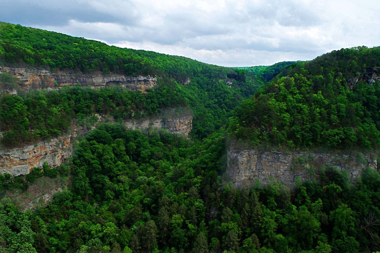
The park’s dominant feature is the dramatic Sitton Gulch which was cut by Sitton Creek. The park is home to many gorgeous hiking trails, cabins and camping, disc golf and a newly opened Five Points mountain bike area.
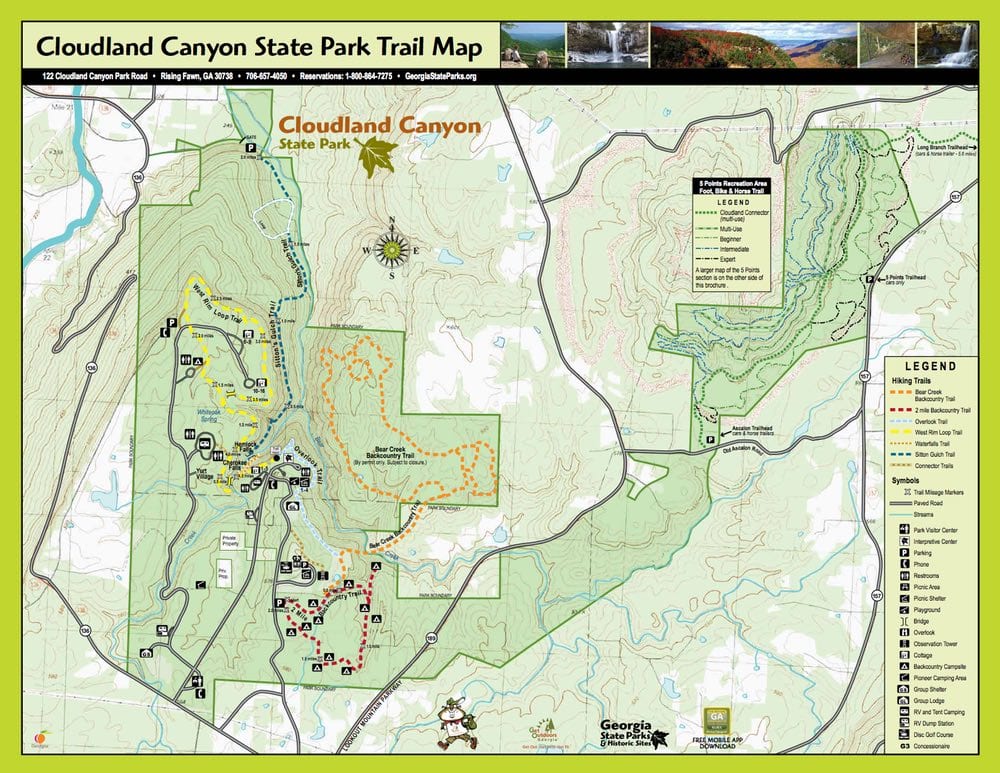
The Best Cloudland Canyon Hiking Map
At Coleman Concierge, we pride ourselves on being tech savvy (re: map nerds). When we first published this piece, we used the State Park map for our Cloudland Canyon Hiking map. That was fine and functional, but I knew we could do better, so I built my own. I think it’s the best Cloudland Canyon hiking map out there and I hope you do too.
The trails are still color coded to the park blazes, but I added photo ops and park amenities. Best all, since it’s in Google Maps, you can load it onto your phone with no special software and navigate to any point on the map. (make sure you are in walk mode or it will not find the route).
There were a couple of places were there were no routes available, so I embedded a link to a map into the trailhead pins. Oh, also since I used Google Maps, there are pictures for most of the pins and geotagged user contributed pictures around the park. (light blue circles) Definitely something to check out for all the map nerds out there. If it doesn’t load, it’s worth it to hit the reset button 😉
| Trail | Distance (miles) | Elevation Change (ft) | One way / loop | Markers | Notes |
|---|---|---|---|---|---|
| Overlook | 1 | 0 | One Way | Light Blue | Great Views |
| Waterfalls | 1 | 350 | One Way | Dark Blue | 600 steps to waterfalls |
| Sitton's Gulch | 3 | 1000 | One Way | Dark Blue | encompasses Waterfalls Trail |
| West Rim | 5 | 550 | Loop | Yellow | Shared Trailhead with Waterfalls |
| Connector | 1 | 0 | One Way | n/a | Connects Main Trailhead to Backcountry |
| Meadowlands | 1 | 0 | Loop | n/a | to Pond |
| 2 Mile Backcountry | 2 | 200 | Loop | Red | Around backcountry camping |
| Bear Creek | 9 | 1200 | Loop | Orange | Permit Needed |
| Cloudland Connector | 14 | 300 | One Way | Green | shared with bikers |
| Can't Hardly | 2.5 | 150 | One Way | n/a | hiker bypass to Cloudland Connector |
| Trail | Distance | Climb |
|---|---|---|
| Overlook | 1 | 0 |
| Waterfalls | 1 | 350 |
| Sitton's Gulch | 3 | 1000 |
| West Rim | 5 | 550 |
| Connector | 1 | 0 |
| Meadowlands | 1 | 0 |
| 2 Mile Backcountry | 2 | 200 |
| Bear Creek | 9 | 1200 |
| Cloudland Connector | 14 | 300 |
| Can't Hardly | 2.5 | 150 |
Overlook Trail
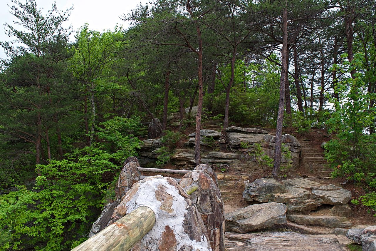
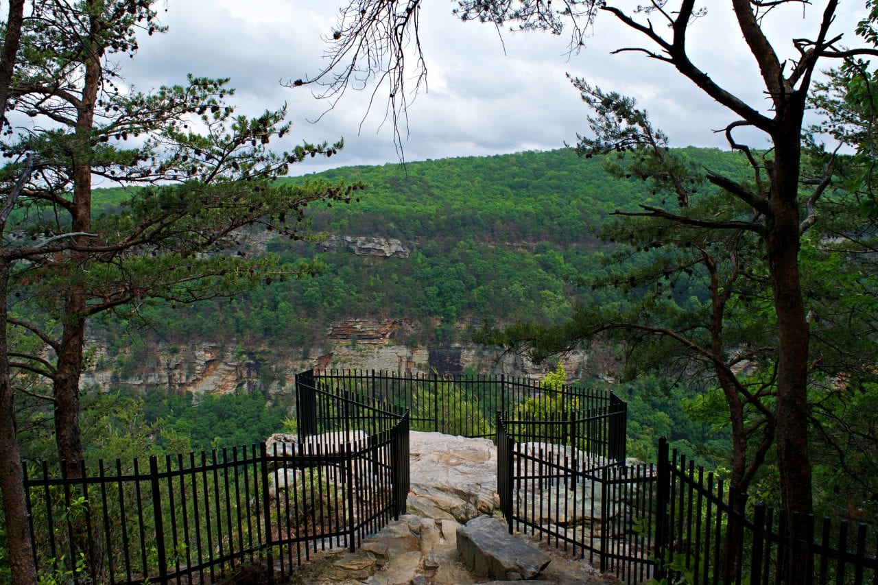
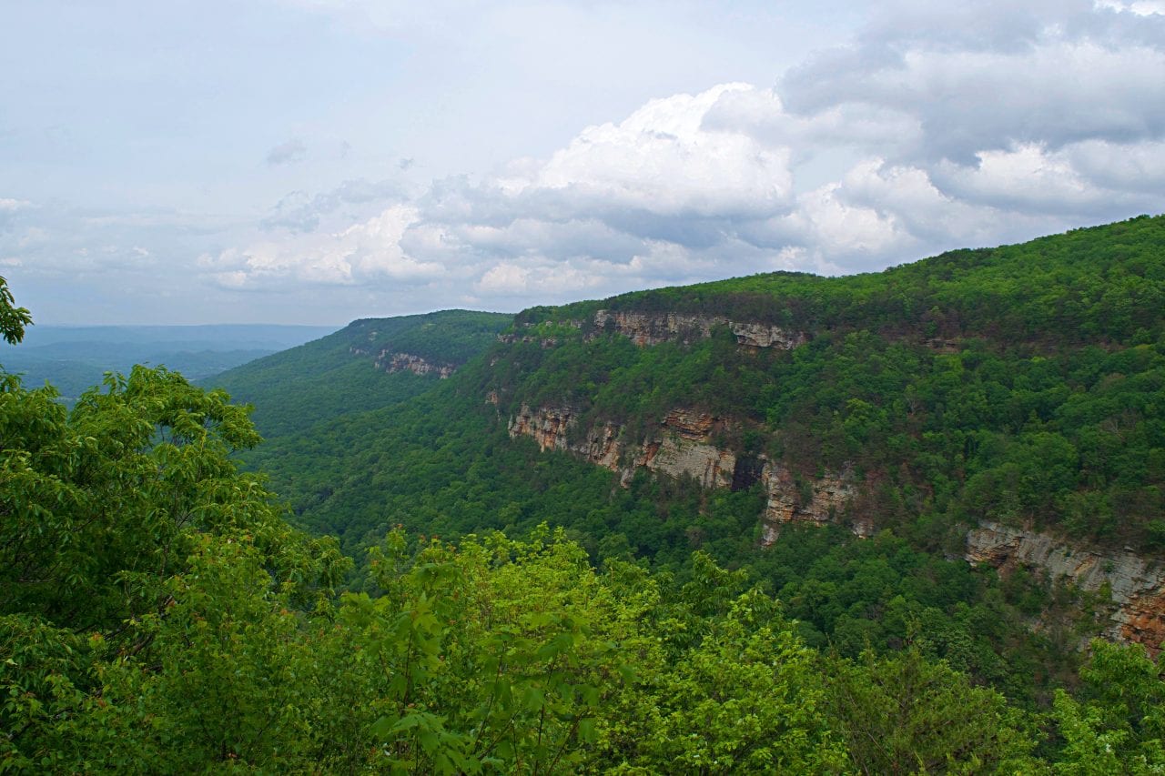
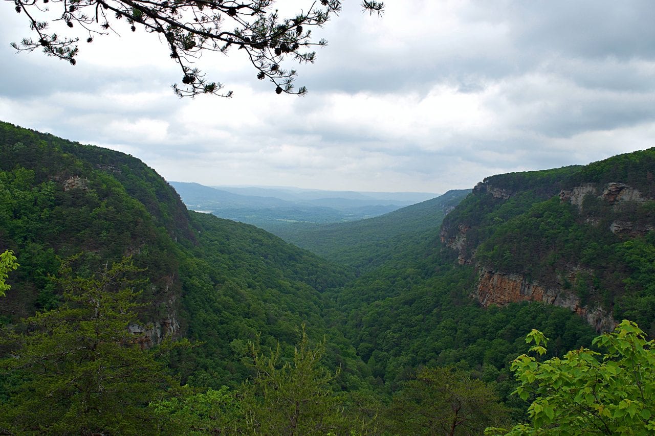
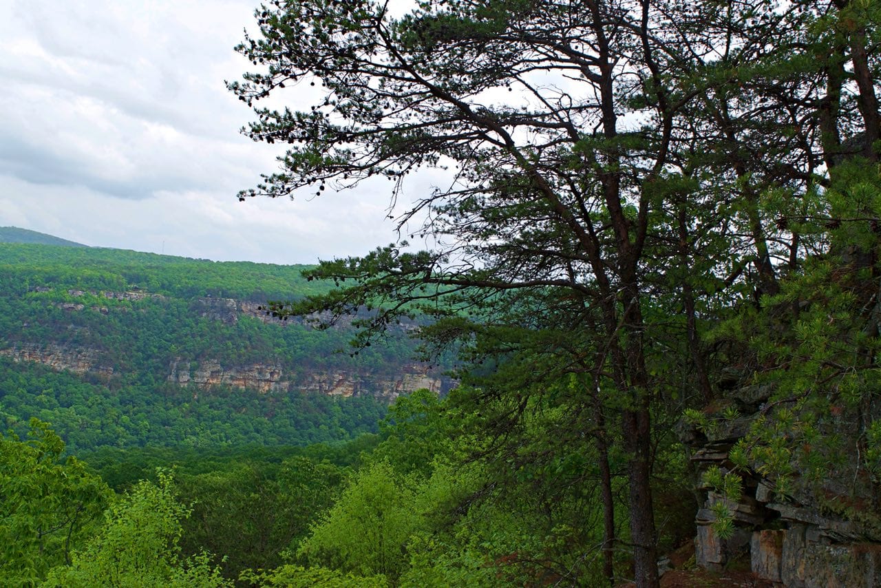
Everybody who comes to Cloudland Canyon does, can and should hike out on the Overlook Trail. Why? Because of the overlooks. The main overlook sits on a ridge that looks all the way down Sitton Gulch. Even if you’re not intending to go hiking, you should venture out to the main platform. It’s not to be, dare I say, overlooked.

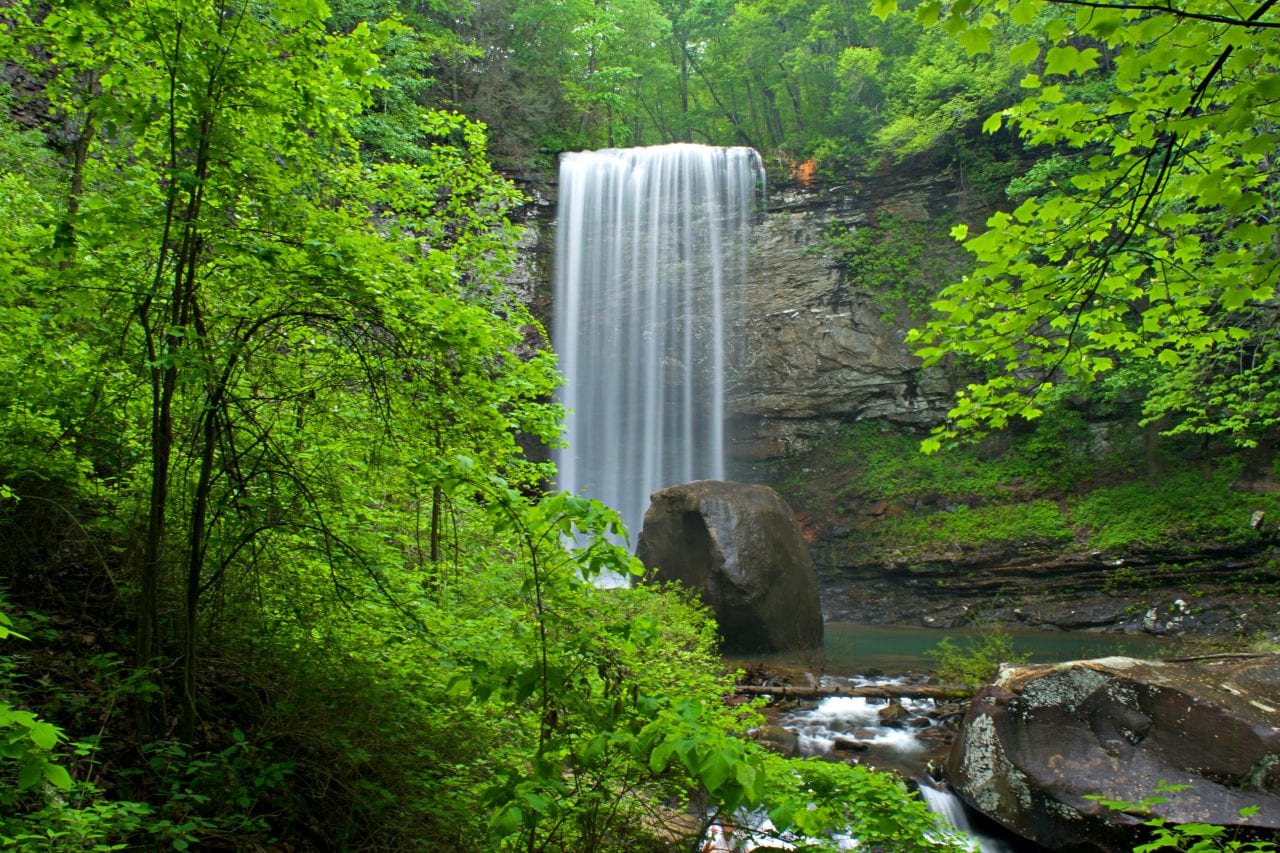
Waterfalls Trail
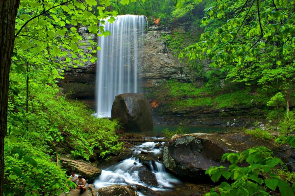
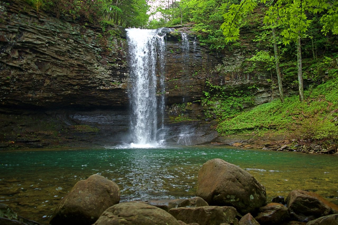
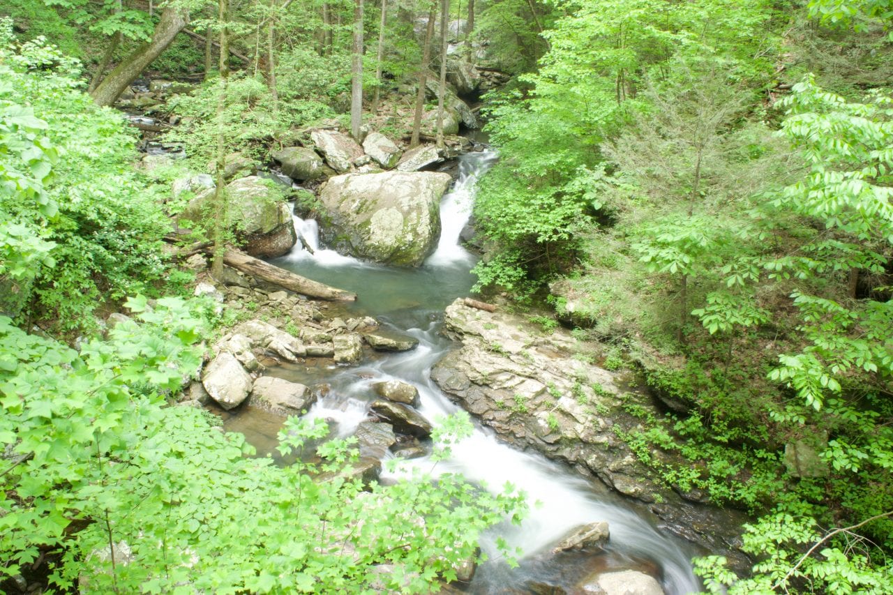
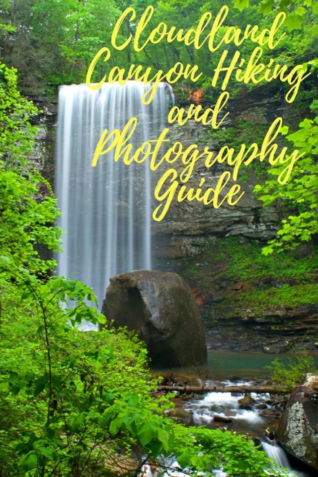
The park service makes a point to say that this trail isn’t suitable for everybody. It is 350’ down and over 600 steps. The meticulous care of the trail construction amazed me. The 600 steps are mostly on well-constructed staircases with railings. Halfway down is Cherokee Falls, where Daniel Creek drops 60’. “All” the way down is Hemlock Falls where Daniel Creek drops 90’.
The turnoff for each falls is well marked, and the falls are relatively close to the main trail. But wait, there’s more. In high water times when White Oak Springs is flowing, you can reach this waterfall by traveling a little way down Sitton’s Gulch Trail, which entirely overlaps the Waterfalls Trail and keeps traveling down Sitton Gulch.
Pro-tip – you can check if this falls is flowing from the Overlook Trail.


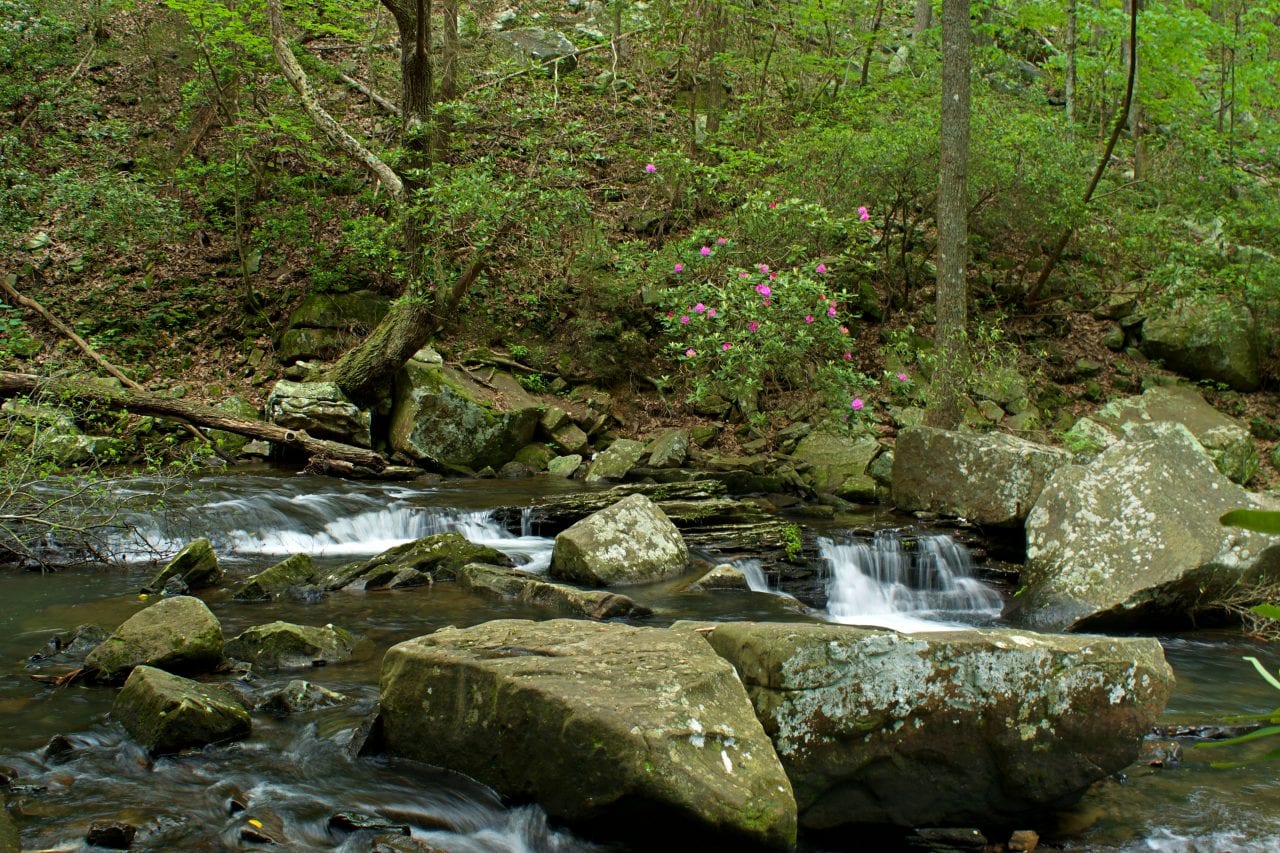
Sitton’s Gulch Trail
This trail entire contains the Waterfalls Trail. If you don’t take the turnoff to Hemlock Falls, you will continue on Sitton’s Gulch Trail down the gulch of the same name. Everybody ought to walk 100’ down this trail to reach the bridge over Daniel Creek. It’s quite a view.
If White Oak Springs is flowing well, there is a dramatic waterfall about 10 minutes hike past the Daniels Creek Bridge. The trail actually climbs for this first ½ mile past the bridge before it finishes descending all the way down the gulch and Cloudland Canyon Park, so you’ll be walking uphill for just a bit to see the second falls, but they’re worth it.


West Rim Trail
Backpacker Magazine once ranked this as one of their top 10 US hikes because of the amazing vistas. We loved this hike. It felt more like a traditional hike than the family day at the park feeling of the Waterfalls Trail. It is presented as a lollipop shaped loop with the 1-mile connector to the Main Trailhead which also services the Waterfalls / Sitton’s Gulch trails. You only travel down the Waterfalls trail a couple of minutes before the West Rim Trail breaks off.
We are huge fans of loop trails, but you might consider hiking this as an out and back along the canyon rim only. The left half of loop was ok but not epic. You didn’t have the canyon feel or the classic view of the other sections of this trail. I would be tempted to double up on the epic views.
We marked an alternative trailhead on our interactive map that gives you direct access to the loop without having to hike a mile each way to join up with the Main Trailhead. You are a 10-minute walk from a lookout that looks down onto Trenton.
Connector Trail
This trail connects with Main Trailhead area to the Backcountry Trailhead/disc golf course. It’s a rim trail that affords views of Bear Creek in the gulch below.
Meadowlands Trail
This is a short, out and back trail that allows you to explore the only meadow ecosystem in the park that ends at a small catfish pond. You can fish without a license and even borrow a pole from the interpretive center if you forgot yours. In the summer, this is a great place to gather berries.
Two Mile Backcountry Trail
This trail loops through a highland forest similar to the western side of the West Rim Loop with a small drop into a hemlock forest. The trail primarily accesses the backcountry camping but people consider it a nice hike on its own.
Bear Creek Backcountry Trail
This trail is open by permit only. It’s the longest trail in the park with the most elevation gain. You cross deep gulch of Bear Creek and climb all the way to the ridge on the other side, hike a loop, return across the gulch and hike up to the ridge on the Cloudland Canyon side. It’s long, hard and you will want to get much more detailed information before attempting this hike
Cloudland Connector Trail
This is a long trail that serves as a connector for Five Points Recreation Area. It’s in a reclaimed coal mining area with a medium growth forest. The trail is shared with mountain bikers too. It’s about 14 miles long with 6 miles of travel between the Cloudland Trailhead and Ascalon Trailhead ( Five Points Recreation Area) 3.4 miles through Five Points and 5.6 miles more to the Nickajack Trailhead. This seems like a great place to bike or hike if your bike breaks down.
Can’t Hardly Trail
This is a hiker’s only bypass to the Cumberland Connector Trail from the bridge at Bear Creek (about ½ way to the Ascalon trailhead) to the Ascalon Trailhead. We didn’t hike this area but it seems like a good first exploration would be to park at the Ascalon trailhead. Then hike an out and back on the Can’t Hardly Trail. You can see if the area piques your interest and if the mountain bike traffic is light enough to venture out on the Cloudland Connector Trail.

Photography Guide to Cloudland Canyon
- Choose the right Camera – Check out this handy guide to help you choose the perfect camera for you and your travel photography.
- Keep your camera steady – Lots of great options are out there from monopod mounts on hiking sticks to mini tripods to carbon fiber collapsible tripods. We came in empty handed but were able to use rocks and posts to steady our camera.
- Use a timer to reduce shutter shock – If you have your camera mounted on a tripod set a 1 second delay to keep down shutter shock. If your camera is wi-fi enabled, you can pair it with your phone for a remote operations. If you already have a remote trigger, you probably don’t need to read this part.
- Bring a polarizing filter – Water glare is polarized so a filter can remove almost all the glare. Also, you will have too much light for long exposures in the forest which a filter can compensate for.
- Play with shutter speed – Moving water looks dramatically different with a fast shutter speed vs a slow shutter speed. Play with this a bit and see what you like. Even if you’re not ready for full auto mode, in most DSLR’s there are advanced settings where you can set the shutter speed and allow the camera to do the rest of the light compensation.
- Look for panoramas– The vast array of vista points beg to be shot in panorama. Play with this a bit and see what you can come up with.
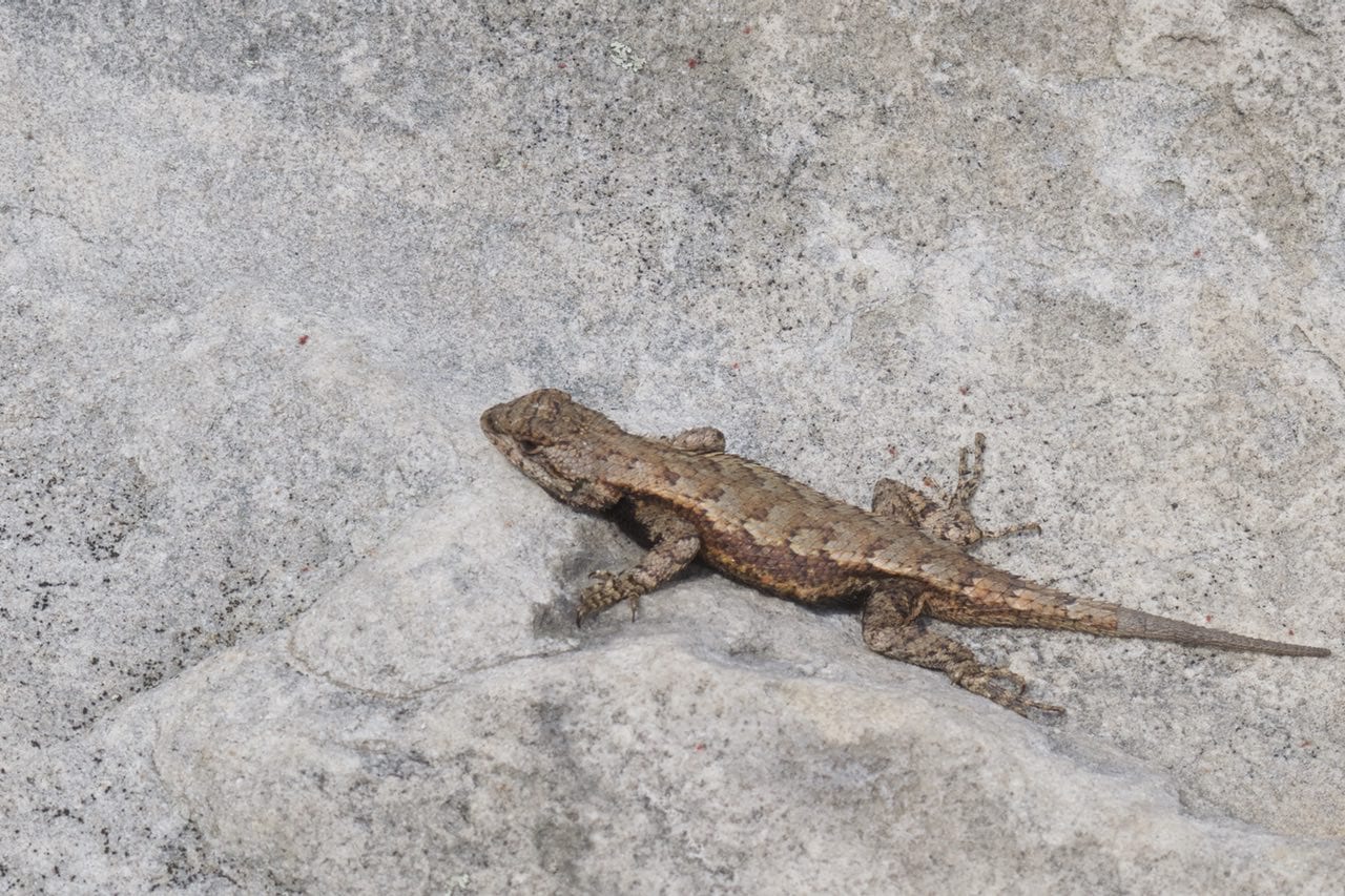
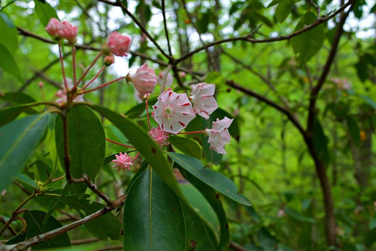
- Explore macros – The forest flora and fauna have subtle textures, shapes, and colors that can make stunning macro shots.
- Optimize field of view – A higher aperture like f1/16 can keep your foreground and background objects in focus. A lower aperture like f2.8 can create that blur effect where you focus on a particular object in the scene.
- Focus on the season – Cloudland Canyon changes throughout the year. Spring flowers, rain driven waterfalls, summer berries and fall color are only a few of the seasonal highlights a photographer can capture.
- Compose your shot – Simple rules of composition can change an outdoor mugshot into a photographic treasure. Try placing objects into the foreground of a landscape shot. Let the trees frame your lookout. Try putting the main object someplace other than the center of the frame. Try using a ⅓ sky, ⅓ background and ⅓ foreground in a landscape shot.
- Experiment – In short, play around a bit and see if you get anything you like. Film is cheap with a digital camera. Below are three shots of the same scene. Notice how we different it can look with different settings.
Daniels Creek Exposure Example
Below are three images of Daniels Creek shot with a long exposure to capture the flow of the water. The first image is over exposed. The second image is a duplicate of the first with the exposure compensated in post processing. It looks ok, but you can do better. In the third image, we used a polarizing filter to reduce the sunlight. Notice how the colors are more vibrant and the shadows are more visible.


Other activities around Cloudland Canyon
- Disc Golf – The course length is 4854’, 18 hole par 54. It’s a well-established course through woody terrain.
- Wild Cave Tour – G3 adventures offers wild cave tours Sitton Cave and Case Cave which are wild caves in Cloudland Canyon. They also offer guided hikes including the rugged Bear Creek Backcountry Trail. link
- Mountain Biking – The Five Points Recreation Area has many trails covering over 23.3 miles of single track biking. There is even bike rental available at the park.
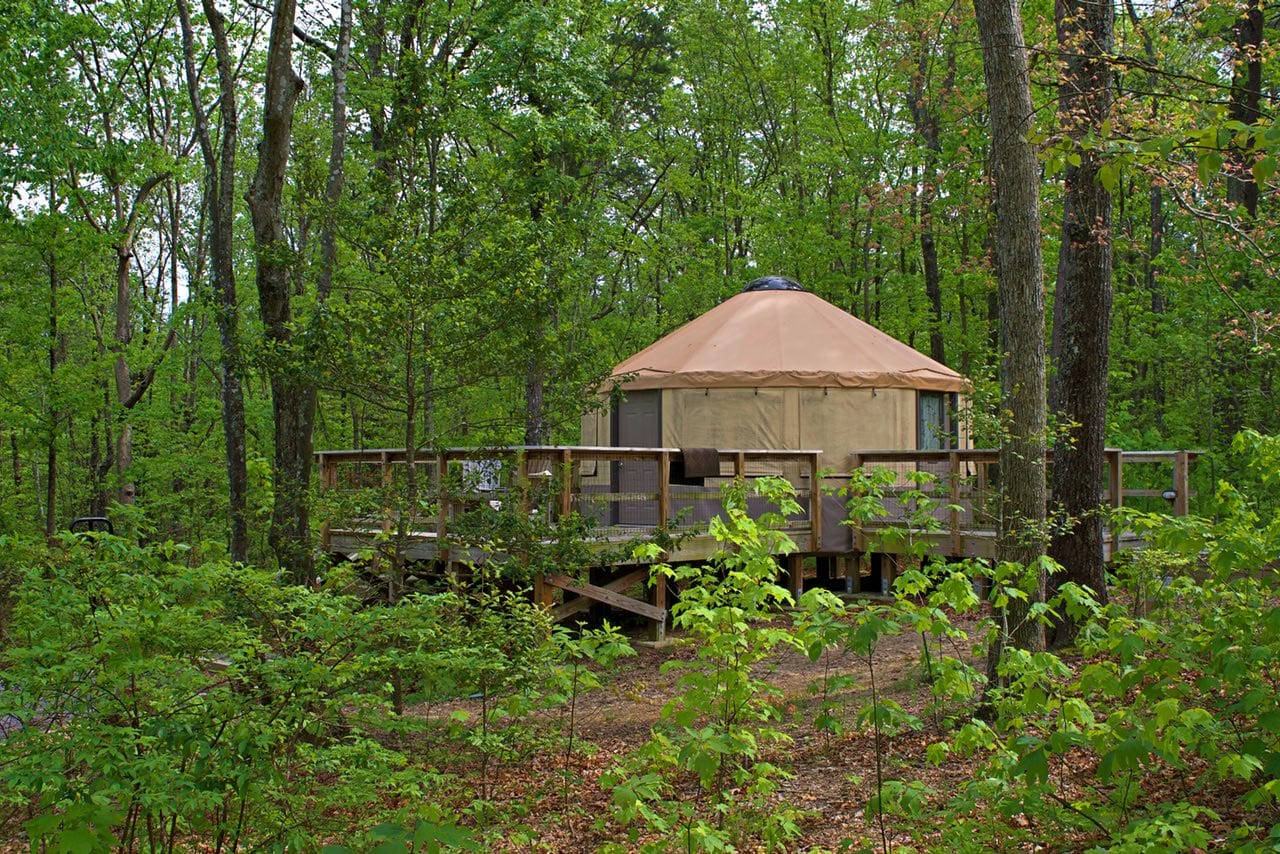
- Camping – From cabins to yurts to backcountry camping it’s all available at Cloudland Canyon. (reservations suggested). What better way to get in touch with nature than to spend a night outdoors.
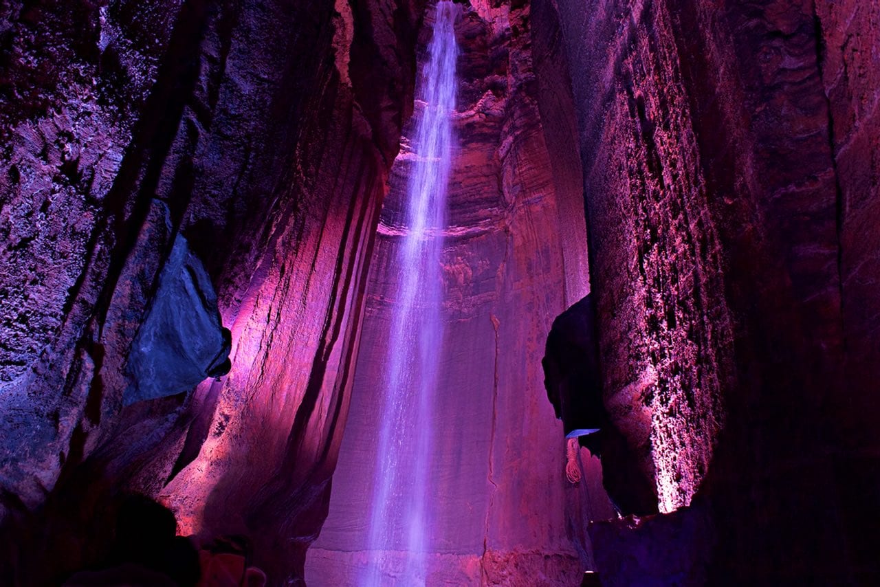
- Ruby Falls – A tourist cave with a 145’ waterfall inside. One of Chattanooga’s oldest attraction that is also located on Lookout Mountain
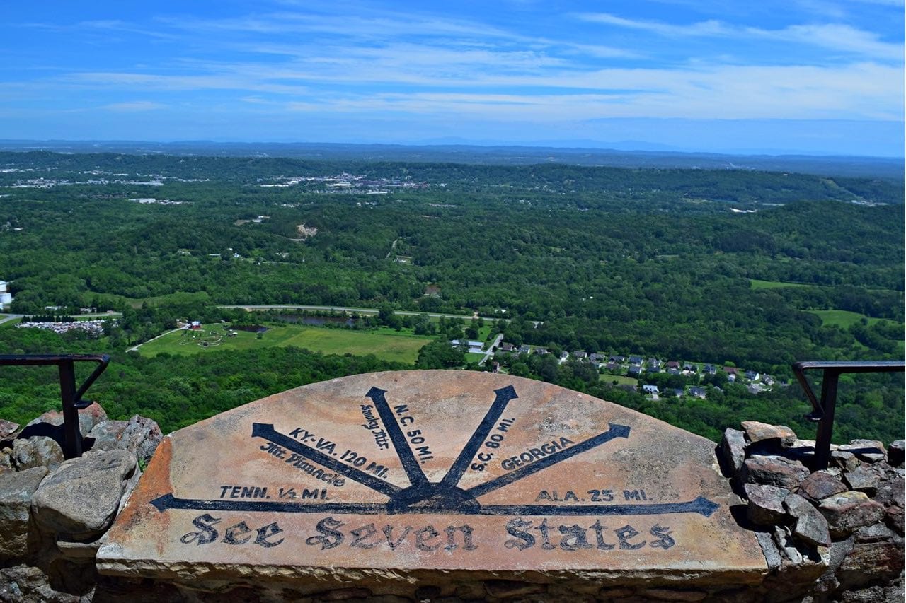
- Rock City – A half plant garden/half rock garden. Paths wind through a boulder field on top of Lookout Mountain. From the vista point, you can see seven states (Georgia, Alabama, Tennessee, Virginia, South Carolina)
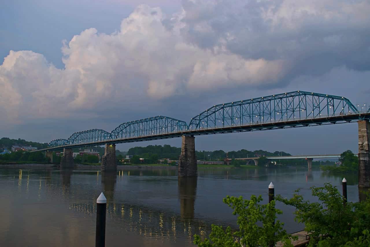
- Downtown Chattanooga – A half hour away from Cloudland Canyon is the city of Chattanooga with a well-developed riverfront. On either side of the Walnut Street Bridge, the world’s longest pedestrian bridge, there is fun to be found. The North Shore features Coolidge Park and electric eat. The South Shore has the Hunter Museum of American Art and the Tennessee Aquarium. Click to find out more about the vibrant Chattanooga Riverfront.
- Lula Lake Trails – Lula Lake Land Trust is a permitted hiking area just around the corner from Cloudland Canyon. They are open the first and last weekend of the month. Hiker can enjoy Lula Lake, Lula Falls, and a fantastic overlook of the Chattanooga Valley.
Our Experience at Cloudland Canyon
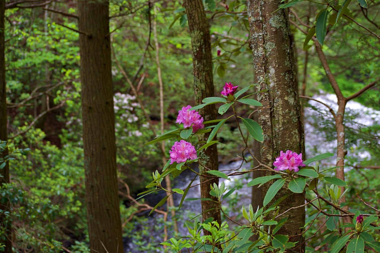
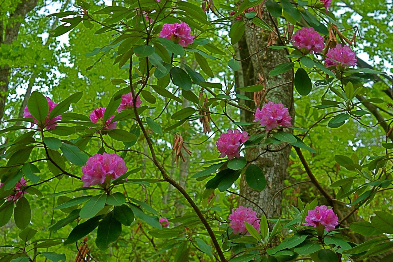
We hiked the Waterfall, West Rim Loop, Overlook and bits of the Sitton Gulch trails. The gulches were deep, dark and filled with hemlocks and rhododendrons. The waterfalls were flowing and scenic. The vistas were breathtaking. All in all, everything we had heard about Cloudland Canyon was true, it’s a fabulous place hike in the southern Appalachians. It’s rare to see anything like the 600 metal steps leading down to the waterfalls on the trails out west!
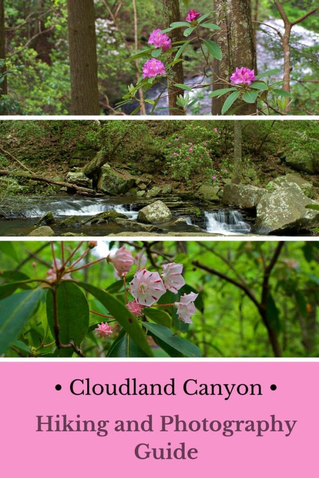
Pin me for later!


 Hi! We are Jenn and Ed Coleman, and together we are Coleman Concierge. It is our goal to inspire you to get out, expand your world, and to seek adventure, even in your own backyard.


